
Had a great sleep after the fire last night and got packed fairly early. Before I could get away I had some of the campers that shared the fire last night offer me a hot drink to start the day. I had already finished my hot milo and had a bit of ground to cover so I thanked them but got moving.
Another relatively flat day today. Which meant immediately heading down into a creek bed and then a 30 ish meter climb. Honestly though the hills today were few and far between and gentle grades when you hit them. Even the saddle which was near 100m climb was smooth.

Passed a few westbounders before lunch. They had stayed at a half way point I planned for lunch. They confirmed the trail was pretty gentle, but still rocky. Rock Gully wasnt anything special but a good place to get water from the tank and stop for lunch.
Mid afternoon my feet were getting a little sore as I came across Ghost Gum Flats. Another trail camp (no water or shelter.) There was a nice platform though so I took a load off to lay down for a while. With the chilling wind I lasted under 10min before needing to move on, or break out the sleeping bag... If you were looking for a shorter day out of Ellery this would be the place to camp though.

By 330 I was strolling into the Hugh Gorge shelter. Not a bad effort considering the amount of people I'd been told were completing this section in the dark. One other hiker here with a pretty cool hammock setup hanging from the shelter rafters. A guided group wandered in just over an hour or so later too. They had a group camp 800m away. Some were looking pretty battered but they had good things to say, mostly about their upcoming evening meal.
Day 8 - 25.3km
I'm glad I was doing a 'shorter' day today because section 5 is HARD. Beautiful and fun, but hard. Of the 15k section I would say less that 2km of it is trail. The rest is rocky ridges or creek beds. Creeks were either really loose sand or big rock hopping sections. Little in between.

You couldn't get a good rhythm going because every stride had to be altered shorter or longer for your next solid footing. If you were lucky to have one. The ground was uneven through all of it too so your foot was always landing at a weird angle. Gave me a few hot spots I had to stop and tape before they became blisters.

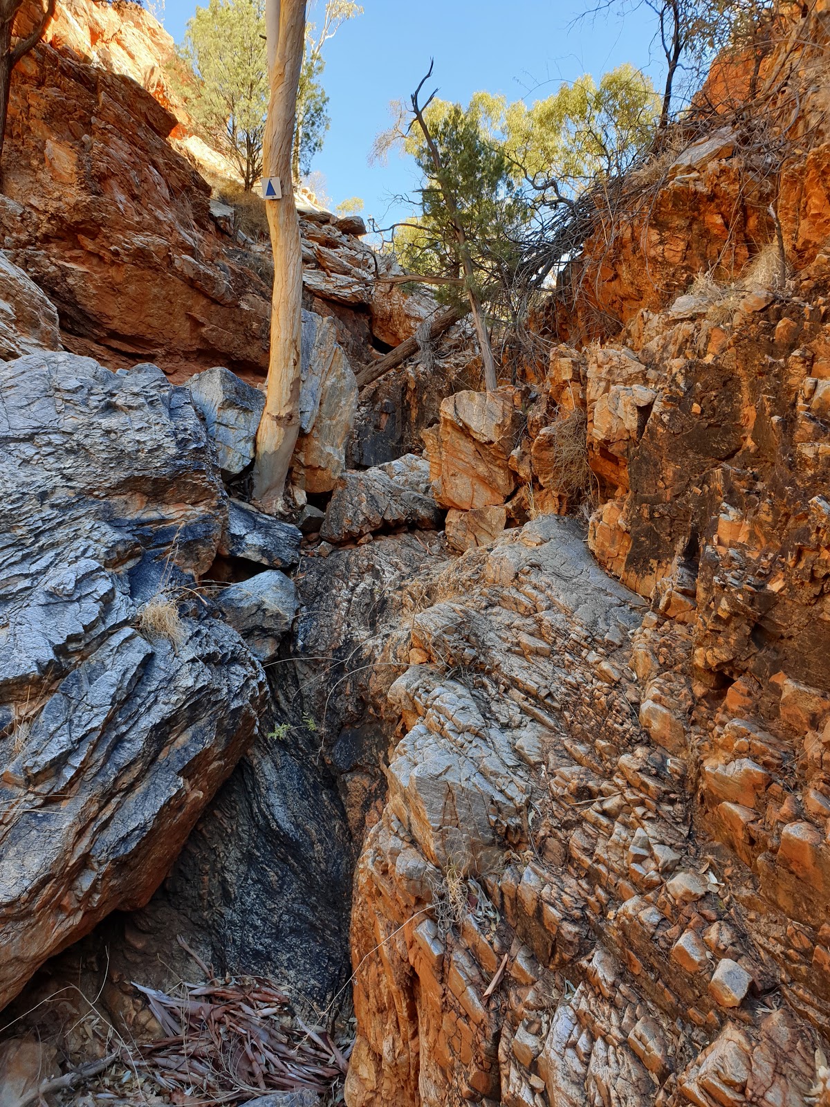
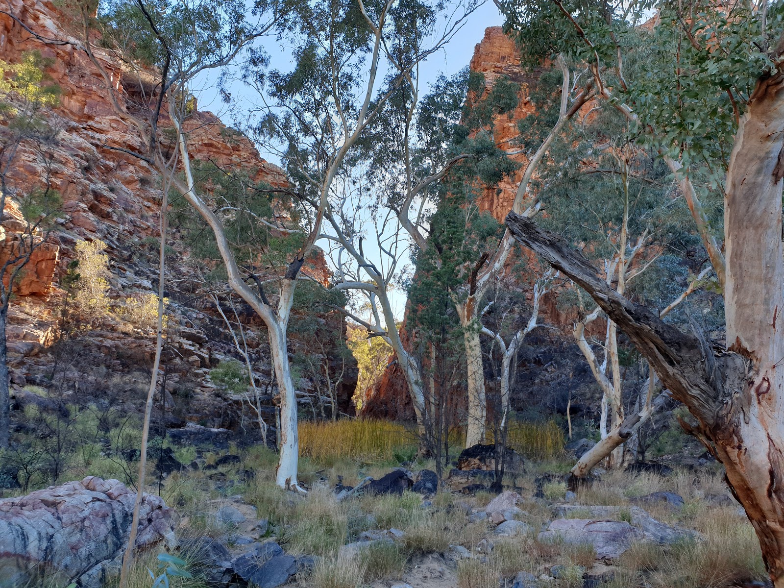
It definitely wasn't lacking in scenery though. Razor back ridge and Hugh Gully were amazing sites to see. I can definitely feel why people think the rangers got the distance on this section wrong because when I was finished it felt a hell of a lot longer than 15km...

After the rocky horror show that was section 5 the next 8k seemed easier but the ~550m climb to Brinkley Buff sure took me longer after fatigue set in from the morning. Every big rock looked so inviting for a sit down and I'm not ashamed to admit there were quite a few sits on the way up. Amazing views from here too and a great spot to camp. Worth the water carry. Also a good opportunity for phone service and a chance to check in.


Day 9 - 11.3km
Heading mostly down to Standley you follow the ridge line for a while and roller coaster a little. There are a few little up bits but nothing that significant. Down the bottom it's back to traversing along a river bed with loose rock underfoot until you come out near the Chasm access road and follow it for a few hundred meters.

Got into Standley well before lunch so I paid for camping and was told to setup on the lush grass. Grass! Upon closer inspection it was only about 80% grass and 20% bindies... but I still managed to find a good level spot on grass-ish. Over to the cafe for a roast pork roll and then onto the Chasm for the midday showing.

Packed with people but after a few prompts from some other photographers enough people got the idea and got out of the way. At least for a moment...

Back to camp for a shower, a bit of a wash of the clothes, sorting out my food box for the next few days and an otherwise lazy afternoon off. Camping came with 10min of super slow free wifi, not quite enough for blogspam part 1 to upload.
Noticed hiker hunger starting to kick into gear so bought a sausage roll for an arvo snack while charging phone near the kiosk. Had a Bacon and Egg burger for dinner, enjoyed the communal fire for a little while but was still in bed by 8.
Day 10 - 28.1km
After spending 10min getting bindies out of my ground sheet (I mustn't have had as good a look as I thought yesterday) it was time to get back on trail. Straight into the hills. Nothing as high as previous days but what they lacked in height they made up for in steepness. Lots of steps to get those leg muscles pumping.
Over the hills it was time to go down some gullies. Paths carved out over eons by water were surprisingly easy to navigate. Some parts requiring the tiniest of scrambles to get past.


This section was pretty badly hit by the fire as well, in one valley all you could see was black. Passed by quite a few people heading west. One was a group of 10 being encouraged along by a guide. S3 is only a small section (13.6k) so I made it to the next shelter before 1130 but decided to stop for a long lunch anyway.
Still pretty windy (though yesterday was a reprieve) but it has warmed up a little allowing me to relax at lunch without needing to reach for a jumper. The remaining 9 ish k into section 2 for the day fell fairly quickly making me think about pushing past my planned camp. Toilets, even drop ones, are a decent luxury on a hike.
The flies at Mulga Camp were worse than anywhere else on trail by 10 fold. Perhaps the worst I've had them in my life. Ultimately I decided to move on figuring they couldn't be any worse. I was right, at least they weren't worse. I had a good backdrop for camp though and it's not too hard digging your own hole...

Day 11 - 24.5km
Section 2 hasn't been all that exciting. Out of the main ranges the views have petered off and the trail is more surrounded by grasslands. There are still some pretty spots though like Bond Gap.

The trail continues on with little change all the way to Simpsons Gap. Passed a few hikers still fresh from Alice excited for what's ahead. Simpsons Gap was pretty busy, short walk from a bitumen road access. There is also a 'Mobile Hotspot' here I was able to use to book accom in Alice for the day I get back to town.

After a long siesta luckily in the shade, with the temp reaching 36°c (97°f) in the sun, I set off on the first part of S1. With the heat now in full swing there's definitely a lot more lizards scurrying off under bushes. Also saw my first snake of the trail. Was a tiny little guy but i couldn't identify him and knowing theres some fairly venomous ones in these parts so I gave him a wide birth.

There was a decent hill which allowed for a few views back to the range I've mostly left behind as well as glimpses of Alice Springs. Mid-afternoon heat was still pretty scorching so I found reprieve at the Scorpian Pools. Not much water but tall enough cliffs to allow me to rest in the shade.

From my rest spot it was only another 3.5k to Wallaby Gap, my last camp spot for the trail. The busiest trail (hike in only) camp I've had too, 6 other hikers just starting their journey. Other sites were busier but those had vehicle access.
Day 12 - 16.9km
The final day started pretty easy with everyone talking about their goals. Most planned just Simpsons Gap, a conservative ~10k but probably a good idea when it's hot and you're just starting out. One pair hiking out were worried about their gas consumption so I was able to leave them with my 1/2 full canister. Can't fly home with it anyway.
I made a good time out of camp probably my earliest so far this hike. On the trail by 730. Night was pretty warm, sleeping bag half unzipped and no liner or base layers needed. Luckily the day didn't seem as hot as the night. Flies were very active again but a slight breeze kept them mostly to manageable levels.
First up, after the hill to get there, was traversing along a great spine for at least a k. Section 1 redeeming itself.

A few more ups and downs before eventually crossing the rail line and heading under The Stuart highway bridge. It wasn't too long before I reached the telegraph station and the official end of the Larapinta hike.

Enjoyed a cold coke at the kiosk there and sat in the shade in the park a little while before getting on my way again. Taking the 'River Walk' into town which is a bike/walking path that follows along the Todd. All in all a pleasant little ending.

Got to the backpackers and the chick at the desk immediately asked if I had done 'The Trail' and when I confirmed said I could go straight through to have a shower and she'd check me in later. I'm not sure who was happier with that idea, but she didn't have to say it twice.
Showered and into 'Town Clothes' I hit up Alice for lunch. Have to sort my pack so its suitable for flying home but for now it's in the luggage storage room, don't think I need to inflict that on roommates... Going to try find a Steak for dinner.
Time to relax and start thinking about the next adventure. Stay safe and happy trails.
